Tsingy de Bemaraha

Tsingy de Bemaraha National Park

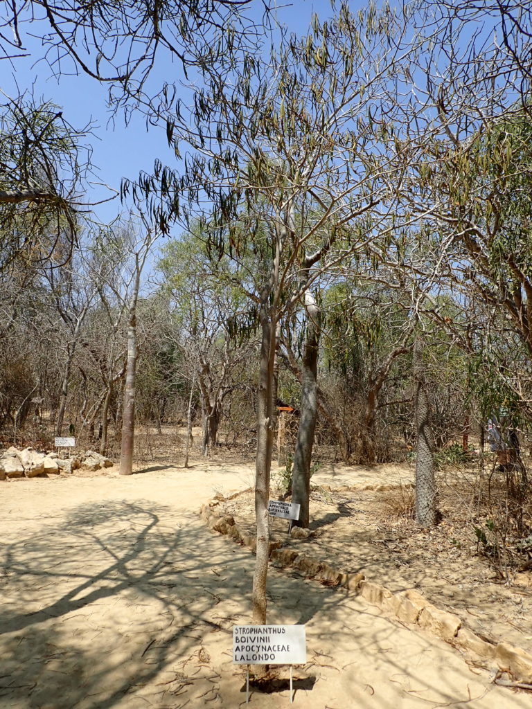
Madagascar has a wide array of ecosystems as a result of ocean currents, winds and the mountain range that splits the country from north to south. Rainfall is a the determining factor in forming these ecosystems with heavy rains in the north and east and relatively little rain west and south. The various national parks that we have visited all had very different climates themselves. Isalo is a prime example of Tapia woodlands and palm savannah, partly man-made due to heavy slash-and-burn clearing for farming (locally called tavy). This feels like a waste of natural resources to the Western traveller but is central to the Malagasy culture and way of living. With large parts of Europe cleared ages ago for agriculture and housing, it is hard to criticize what is happening here. Nevertheless, the ecosystems provide for a large amount of income from tourists and as such there should be an economic rationale to preserve them.

Ranomafana is a good example of montane rainforest at altitudes between 800-1300 m which makes it cooler than lowland rainforest, with lower canopy and denser undergrowth that holds many ferns, moss and lichen. This was particularly visible in the primary forest. Kirindy in turn is mainly dry deciduous forest, which must have covered large parts of Western Madagascar many years ago. It is less diverse in plant growth than the forests in the east but has a higher level of endemism. In the dry season, canopy leaves are shed and wildlife moves to the ground. Snakes, tortoises and other amphibians bury themselves in the humus on the floor with larger wildlife preying on them. When rain returns, the forests will return to a sea of green. We would have liked to do Andringitra national park in the south-west as it one of the few examples of cloudforest (rainforest above 1300 m), called this way because it is sometimes cloaked in mist. However this park was closed due to hostilities of local tribes towards tourists and it is unclear how long this will persist.

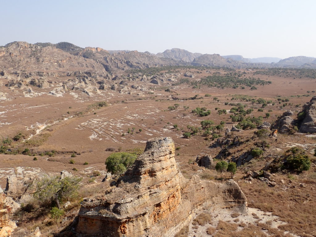
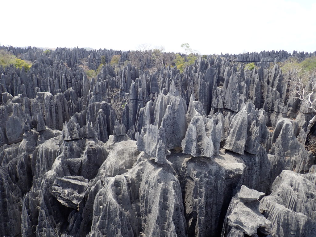
There is one particular ecosystem in Madagascar that is a must-visit for travellers, the limestone karst formations that are locally known as tsingy. They are found within the dry deciduous forests and hold a striking variety of plants and wildlife. The limestone formations are in essence ancient coral reefs that have been pushed upward due to geological activity. Once above water, they have been eroded by the heavy monsoon, creating a vast plateau of knife-edge pinnacles. We were told the Malagasy word tsingy means ‘to walk on one’s toes’ which is the best way to traverse the plateau. Another translation is ‘where one cannot walk barefoot’.

Ferry over the Tsiribihina river.

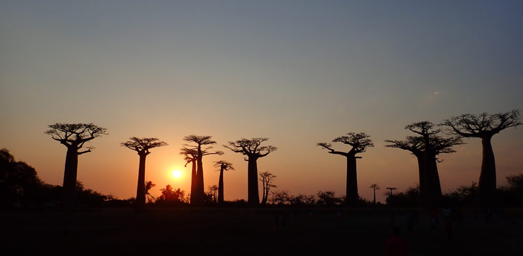
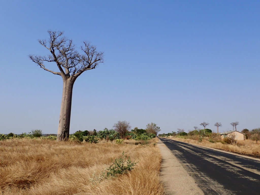
We visited the area of the most famous tsingy, the UNESCO heritage site Tsingy de Bemaraha. It can only be reached by road from Morondava and takes eight hours over unpaved tracks for which a good 4×4 is necessary. The track is sandy, rocky and adventurous and twice the car had to be loaded on a makeshift ferry (two large canoes with a platform) to cross a river. The trip itself is already very rewarding for those who like to go off the beaten track. The track will also take you early past the Allee des baobabs seventeen kilometres from Morondava, even before you reach Kirindy. As this is best viewed at sunset, most travellers stop here on the way back.
Roughly halfway the drive is a city called Belo sur Tsiribihina. Most drivers will stop here for lunch. There is a restaurant of remarkable quality called the Mad Zebu that is not to be missed. Intriguing how this restaurant is probably the only decent place for western travellers to get a meal but at the same time outperforms almost every other restaurant we’ve been to during our trip in much more densely populated areas (Chez Jenny in Antsirabe deserves to be be mentioned here as well).

View over the Manambolo river

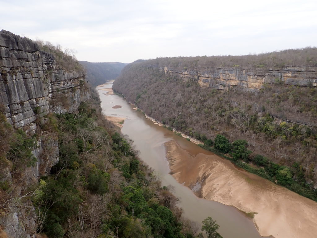
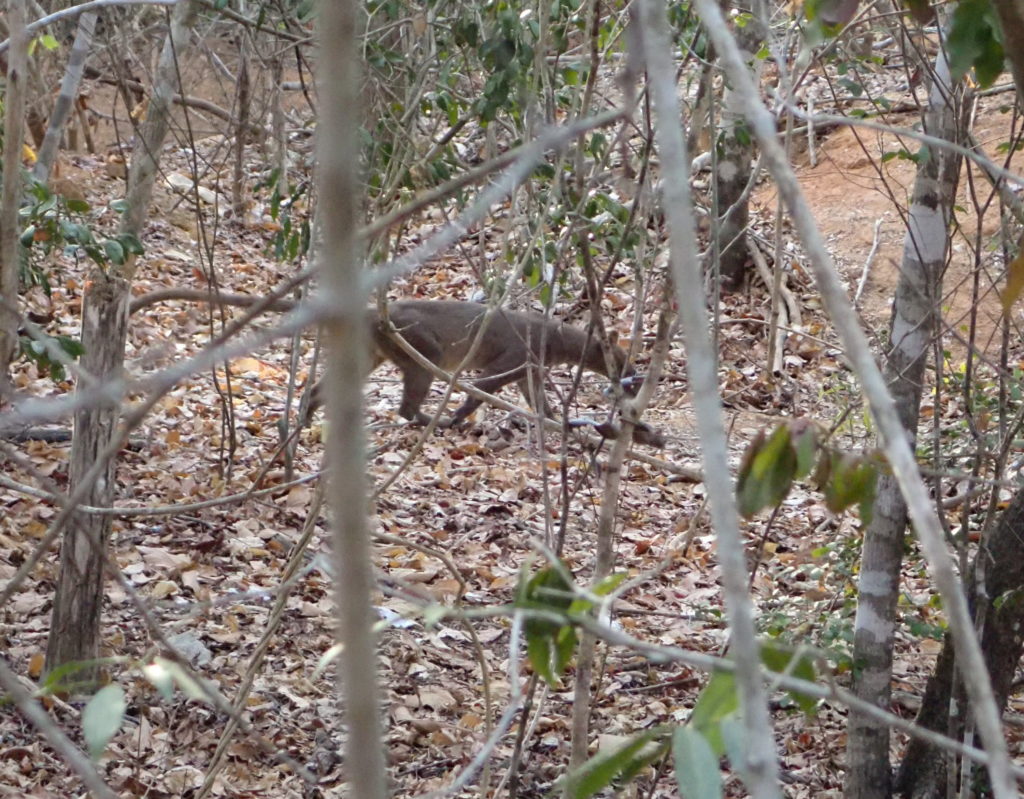
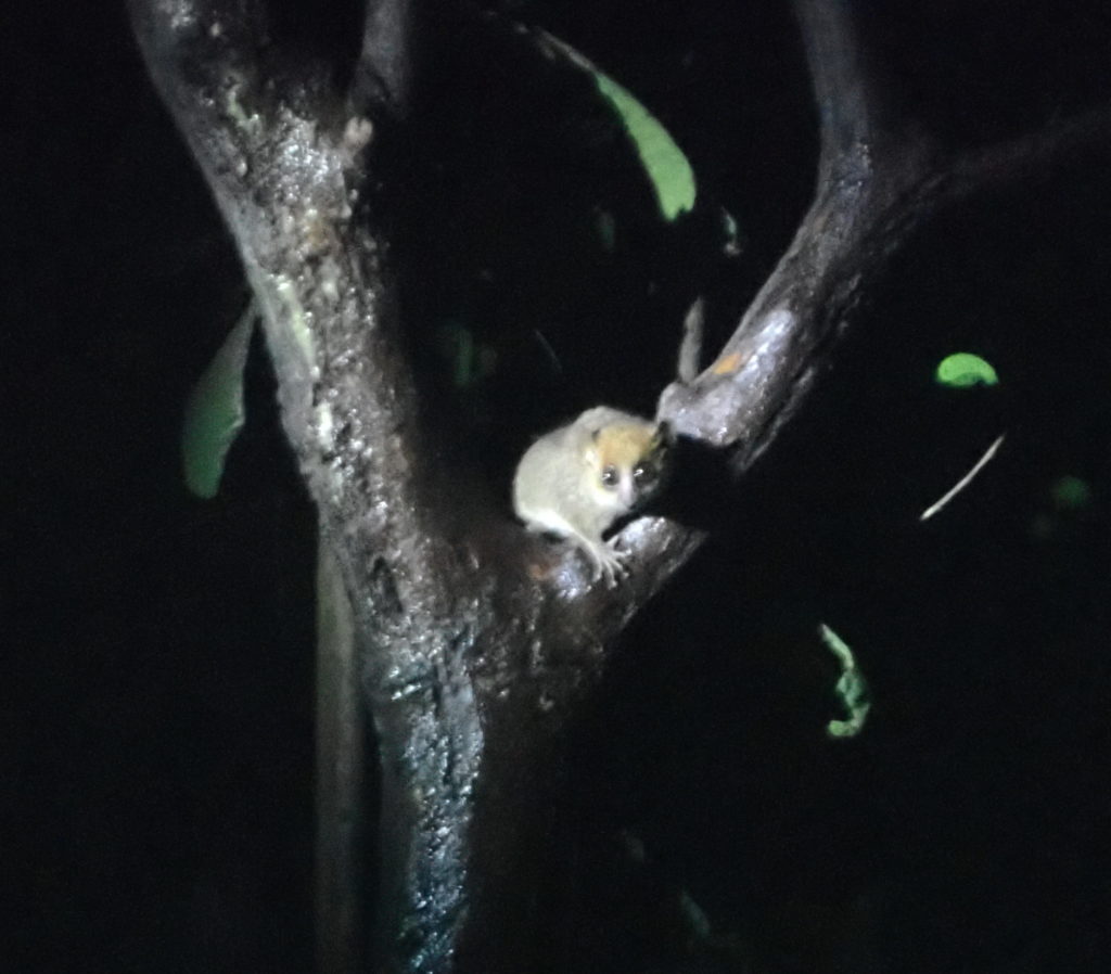
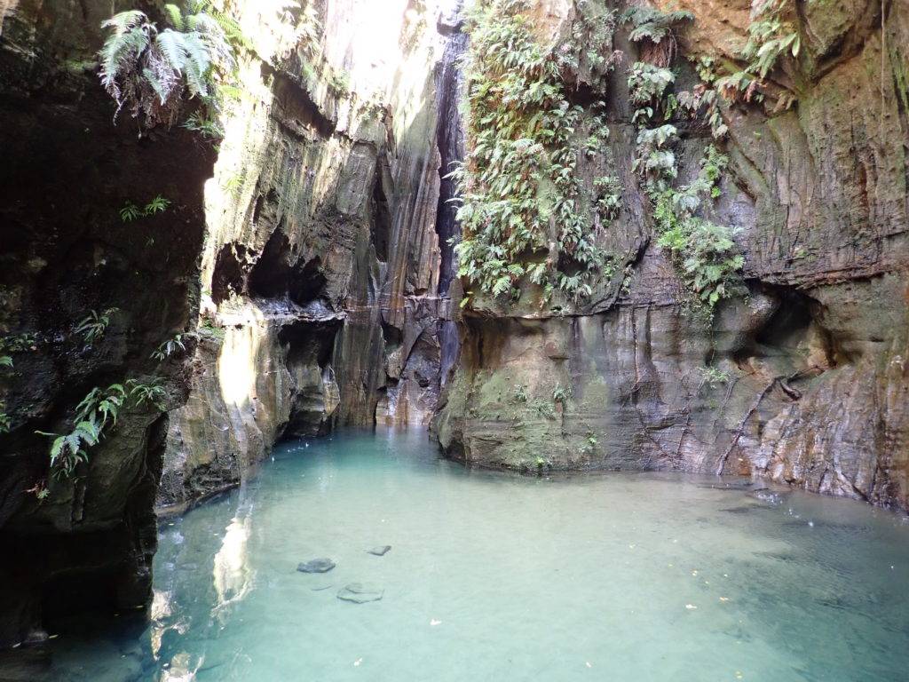
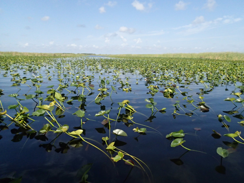
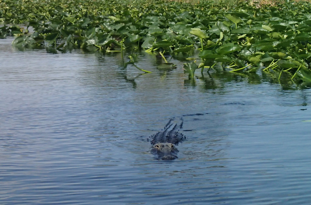
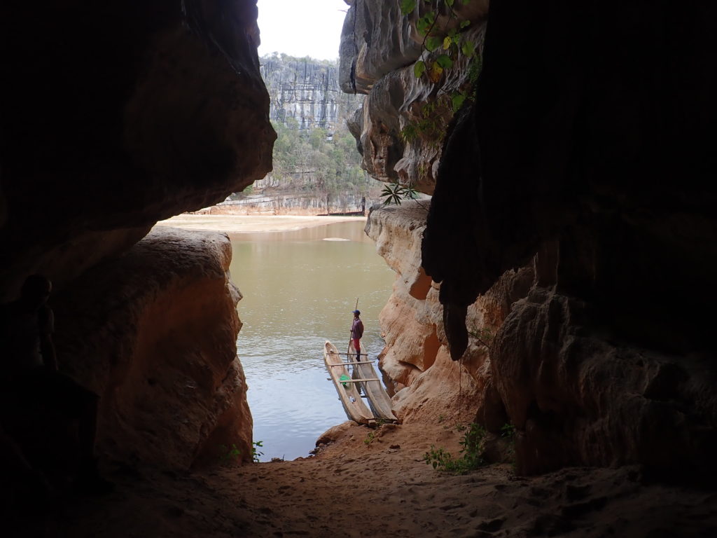
Near the Tsingy de Bemaraha park lies the city of Bekopaka from which to plan the visit to the park. For the first day we booked a local pirogue (canoe) trip over the Manambolo river that took us past caves in the cliff walls along the river. We stopped at a number of caves to see stalactite and stalagmite formations and then the boatsman took us to a remote beach from where we made a three-hour hike to a local tsingy. This was a relatively tough climb and we had only expected this tour to be by boat. However, the tsingy plateau was beautiful and more rewarding than the popular Small Tsingy hike close to Bekopaka that we had booked for the afternoon. On the way to both tsingys we saw some lemurs and amphibians but nothing too special.

A cave visit by pirogue

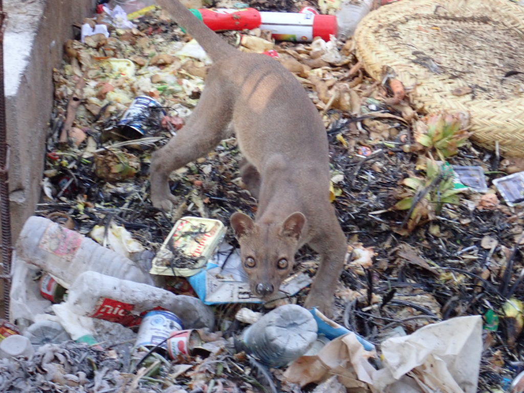
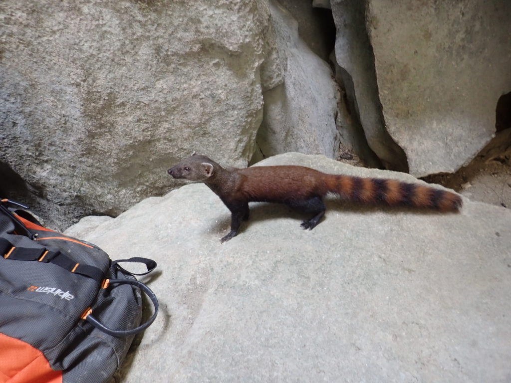
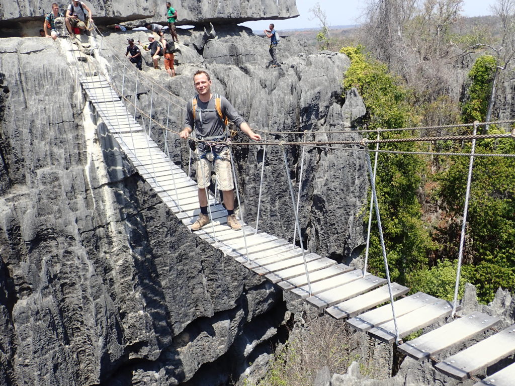
The main hike to Grand Tsingy we had saved for the second day. This is a tough hike which involves a lot of climbing, some with the aid of ropes and climbing equipment. It takes you through caves, over ladders and small wooden hang-bridges to two viewing points over the Grand Tsingy that show the limestone formations in all their glory. There are supposedly eleven different species of lemur but we did not see many which was fine because that is why we visited this park. We ad late lunch in a place called the ‘cathedral’, basically a cave system with partly open roof, allowing in natural light and plant growth to develop. There were some red-tailed mongoose begging for our food that had no fear of humans anymore and we had to shoo them away.

The not so shy red-tailed mongoose

The tracks through the tsingy are narrow and on a busy day progression can be slow as the slowest group dictates the tempo. It will be interesting to see how this park is going to deal with the inevitable flow of more visitors in the coming years as Madagascar further develops. The trip itself is very entertaining and should be on the itinerary of every visitor to Madagascar but due to the long day drive to and from Bekopaka, it takes a decent chunk out of any holiday. It is possible to get charter flights to Bekopaka from Antananarivo but this is pricey and you’ll miss the great adventure on the road.

Small bridge connecting tsingy plateaus

The next day we made the long drive back and stopped at the Allee des baobabs to see the sunset. That night we finally did our first clubbing, in a very decent place in Morondava called Insomnia. A well-deserved break after two weeks of hiking through all the natural richness that Madagascar has to offer.

Sunset over the Allee des baobabs

Kirindy National Park

Around 160 million years ago, Madagascar was part of the large prehistoric continent Gondwana that consisted of current day Africa, South America, Antarctica and India, among many other landmasses. The eastern part of Gondwana, holding mainly Madagascar and India, first split off from the western part which included Africa. Subsequently Madagascar split off from Antarctica and then finally some 80 million years ago from the Indian subcontinent. It remained an island until today and as a result Madagascar developed into a biodiversity hotspot, with 90% of its wildlife found nowhere else on earth.

This includes the lemurs, descendants of ancient primates that once roamed Africa. Lemurs are known to have developed in Africa while it was already separated from Madagascar and the best accepted theory for their existence in Madagascar is that they accidentally crossed the Mozambique channel on rafts of vegetation. To allow for the evolutionary diversity, this must have happened a number of times over a period of millions of years.
Then around twenty million years ago, continental plates shifted and with it the ocean currents, rendering such rafting trips impossible. While in Africa lemurs started to compete with monkeys which evolved much later and had many advantages over lemurs and other primates, the lemurs of Madagascar had no such problems and developed into many different species, filling different evolutionary niches.

When the first (Asian) humans arrived in Madagascar about 2000 years ago, the country held well over a hundred different lemur species, some of which have now unfortunately gone extinct.

We had already seen various lemur species in Isalo and Ranomafana. Being ahead of schedule as a result of skipping the train ride to Manakara and boat ride over the Canal de Pagalanes, we decided to add another park to our itinerary. We agreed on Kirindy National Forest, close to the city of Morondova that was already on our list of destinations. Not only does Kirindy hold eleven different species of lemur but it is also the best place to see the fossa, Madagascar’s largest predator and family of the mongoose.

We arrived in Kirindy late afternoon after a fifty kilometre drive from Morondava, where we had spent the morning on the beach, and we immediately booked the night walk. This was a slightly disappointing experience as we were slow-going, paired with people that seemed unhappy with any type of adventure and formed too large a group in the dark. We only saw a limited number of animals and decided to start the morning hike particularly early the next day at 7am.

The experience the following morning was a complete reversal of the night before. Already at the start of our walk we encountered the fossa, a remarkable animal with a very long tail which helps it hunt the trees for lemurs. This fossa had discovered a waste dump while searching for food and we were able to get very close until our guide became nervous and pulled us away. Fearful of having to go through a rabies treatment if we dwindled any longer, we complied.
There are a lot of fun facts on the fossa and you can find more information on Wikipedia.

A prowling fossa
No really fossa, we are not after your trash pile, we just wanted…. run!!!

After leaving the fossa behind, we kept running into groups of maki (a type of lemur moving on four legs) and sifaka (using only two, making it seem like a dance), passing us by with their young at short distance as long as we remained fairly still. Others were jumping from tree to tree, remaining in view as long as we did not annoy them too much.
All of this and the occasional chameleon made Kirindy by far the best place we visited to see Madagascar’s wildlife.

Ranomafana National Park

Two-thirds along the RN7 road, at the crossroads with the RN25 towards the east coast, lies Fianarantsoa, a gateway city to the southeast. We were supposed to take the train here and follow the scenic railroad down to Manakara at the coast. However the FCE railway corporation had reduced its timetable for departure to only twice a week and our itinerary did not allow for a three-day waiting period. This was disappointing as the experience came highly recommended. Yet this a country that is difficult to travel efficiently and even more so on the fly and we had not expected to be able to follow our full itinerary. We changed our plans and this also meant dropping the boat ride along the Canal de Pangalanes, a canal that connects several lakes stretched along the east coast.
Instead we opted to immediately head for Ranomafana national park, a large area of mostly rainforest fifty kilometres from Fianarantsoa. Here we settled for the night.

Madagascar sunset is around 6.30pm and sunrise is at 6am. We had already changed our daily rhythm to get as much out of the day as possible, sleeping at 10pm and getting up 6.30am at the latest, to be able to take advantage of the early park opening hours and animal activity, many of which are nocturnal. upon entering the park the next day we booked the longest one-day trip possible, an eight-hour hike that takes visitors through bamboo forest, secondary forest and most notable primary forest where trees are taller and undergrowth much richer and more colourful. Most of the trails through the bamboo forest were relatively easy although our guide took us off the beaten track regularly to climb and claw our way to the best lemur spotting sites. We encountered red belly lemurs at first and then the black and white ruffled lemur, a much rarer find.
The trail through the secondary forest proved to be slightly more difficult to tread and once we reached the primary forest it turned into a series of long climbs, steep and slippery descents and many cobwebs. A very limited number of people apparently attempt this hike and our guide was rather short, leaving it up to us to clear the forest track of spiders and webs.

The black and white ruffled Lemur

The walk through the primary forest was stunning in its beauty and it is very rewarding for those with a reasonable level of fitness. When you attempt this, make sure you bring enough water and some lunch as you’ll burn a lot of calories. This part of the park did not seem to be much richer in wildlife as the other areas although we did chance upon a ring-tailed mongoose that crossed our trail. This mongoose is active by day and relatively common in Ranomafana. Unfortunately it was gone in a split second before we could even think about getting our cameras out and I even missed it completely.

Waterfall in the secondary forest

On our return to the bamboo forest we again spotted a number of lemurs which brought our total to five different species. Throughout our hike we also encountered various geckos, chameleons, frogs and one snake that our guide snatched from the undergrowth and offered us to hold by its tail. We skipped one hour of our hike to go back to the hotel, get some food and return for the night ‘walk’. This is a two-hour activity along the road outside the park where guides point out more animals, mainly frogs and chameleons that come out of hiding during the evening. The guides also crush a banana on the tree stem to lure the small nocturnal mouse lemur. It did indeed come out to lick the tree but got immediately photographed and flashed by 15 people which was probably a bit stressful for the little animal and we decided to leave it alone after that.

The small nocturnal mouse lemur

This Ranomafana frog just wanted to say hello.

Isalo National Park

Approximately fifteen kilometres east of the coastal city of Toliara, along the RN7 road, is a small place dedicated to the plants and trees of Madagascar, simply called the Arboretum. It has a decent restaurant attached to it and makes for a very nice stopover to have lunch. The tour of the Arboretum will take about one hour and you can order your meal before you take the tour to have it ready when you return. A guide will lead you through some of the more remarkable trees and plants that are endemic to Madagascar and point out which ones are used for medicinal purposes, for glue, for survival or for other things useful. September is at the end of Malagasy winter and no plants or trees were in bloom and they all looked rather withered. I suspect this place is probably best visited in Malagasy summer (rainy season) but it was still an interesting introduction to the country’s flora.

The so-called mother-in-law tree. Named this way because it looks nice but is in fact very dangerous…

Our next stop and destination for the day was Rahonira, the village that acts as a gateway to Isalo National Park. We booked a guide to the park in the evening to make sure we could have an early start and avoid the searing heat in the afternoon. The park is one of the most visited in Madagascar and has a number of trails that lets you hike its beautiful mountain ridges and savannah-like vegetation that is typical for this part of the country. Madagascar is more or less divided into two different types of climate with the west mainly a dry area with long desert plains. This leads up to highlands in the centre that act as a boundary between the dry west and changes into lush rainforest towards the east coast. Parc National de l’Isalo is a park dedicated to the dry weather climate with its long stretches of yellow grass, sandstone formations, canyons and oases. There are three lemur species, lots of birds and interesting trees and plants, such as Pachypodium Rosulatum or Elephant’s Foot Plant, a plant growing on rocky soil that stores water in its trunk.

Starting early next day we drove to the park and discussed the possible trails with our guide. We settled on a six-hour hike along the mountain ridge that would descend into the valley and take us past waterfalls and little streams to the so-called piscine naturelle, a beautiful natural pool. The first part of the hike was therefore filled with beautiful views of barren landscapes and some simple climbing and birdwatching.

Rock desert with occasional vegetation

We were able to arrange lunch in the park where guides and local residents have set up a barbecue site where they will prepare a dish of rice with either zebu (the local cow) or with chicken. This site also holds the best chance to see lemurs and we’ve spotted a dozen ringtailmakis that were passing by along one of the trails. They have grown accustomed to humans and spotting them did not equal the excitement of discovering a truly wild animal but it is great for photographing and filming.
If you look closely at the final seconds of this short film, you’ll see the last maki accidentally dropping her baby and returning for it.

After lunch we headed to the piscine naturelle which was a steep descent at times and took us past small streams, which we crossed by stepping on the boulders in the water. This area was much more overgrown with trees and plants and the pool and waterfall in the end were beautiful to behold. We were the only ones to jump into the pool, the water is freezing but the short swim to the waterfall was well worth it.

The natural lake with waterfall

This ended our hike through the park but not our plans for the day. Close to the park is a stone formation with a hole in it that aligns perfectly with the sunset. To reach it we had to go offroad for a short distance which was fun and nothing our 4×4 wasn’t able to handle. Being pressed for time we may have turned it into a rally somewhat which annoyed hikers along the sandpaths but added greatly to the overall excitement. The Fenêtre, as the rock formation is called after the French word for window, was slightly disappointing. Not for the view which was stunning but for the vast amount of people grouped together to occupy the ten square meters where the best pictures could be made. This made for an elaborate shuffle of people with large cameras and tripods moving in front of the group to claim priority and annoyed remarks from the rest and this went on and on. I joined this little dance and got a few good shots from behind the frontline while the rest just took pictures of this strange event unfolding.
The sunset itself was obscured by a large passing cloud which seemed to be nature’s rebuke to human madness.

The Fenêtre

Madagascar from the southwest to the centre

Baobab tree on the RN7 from Toliara to Antsirabe

After one and a half year of limited travel, it was about time to get the backpack out of storage and find a new and exciting destination. This time I wasn’t planning on going alone but had made arrangements with René and Gijs, two friends from university. Rather quickly we settled on Madagascar as a destination over Japan (not our favorite season) and New Zealand (too far for 20 days).

Planning proved to be much harder than anything else so far. While I like to travel in a happy-go-lucky way, booking flights and hotels a day in advance, this seemed to be a poor strategy for Madagascar. The country is huge and has many airports but only a few of them are used for regular passenger flights. There are private charter organisations willing to provide a more customized experience but they seem tailored to the happy few in this world and quotes came in very expensive.

We decided to book a few domestic flights and do a large part of the island by car with local driver. I had done this before in Sri Lanka with René and liked the flexibility and the little unexpected stops along the way in small villages and lesser known touristic spots.

Infrastructure quality in Madagascar is patchy and it’s advisable not to expect to cover large distances per day. We decreased our list of destinations from six to three, dropping the north, the Sainte Marie island and almost all of the east. We then settled on the national parks along the national road RN7 from Toliara in the southwest to Antsirabe in the centre, the Tsingy the Bemaraha national park that everyone visits and Nosy Be, a beautiful and touristic island that is for some visitors the only part of Madagascar that they’ll see as it has direct flights from other continents.

Our trip was off to a good start when we we landed in Antananarivo, the capital, and discovered that our luggage was still somewhere in Europe. It is refreshing to realise that while we’ve made our trip as flexible as possible to allow for delays, bad weather and genereal inefficiencies common to Africa, it is actually KLM and Air France messing up to such a large extent that four days later we still have no clue where our luggage is.

There was no time to stay in the capital so we bought some essential clothing and a toothbrush and took our flight to Toliara where our driver would pick us up and where our adventure would truly begin. A bit more basic than expected, in a simple outfit and sharing a single phone charger but with all malaria pills, travel documents and digital cameras accounted for. Makes you realise how little you actually need.

Cartagena de Indias

I fell in love with Cartagena on my very first evening in the walled city, walking from my boutique colonial hotel to nowhere in particular, losing all sense of direction in the small streets at dusk and chancing upon little parks, churches, horse-and-carts and rows of colonial buildings that were drenched in old wealth, history and a determination to withstand the force of time itself.

Cartagena was founded in 1533 on the northern Caribbean coast of what is now Colombia, but for most of its history the Spanish northern colonies were collectively called New Granada. The discovery of nearby native American burial sites with vast amounts of gold led to rapid growth and the city’s strategic location and rare official status as a slave-trading centre meant that a lot of citizens became very wealthy. This in turn attracted the attention of many pirates and privateers and the city has been besieged, raided and plundered over and again. To stop this from happening, in the 17th century the Spanish finally decided to fortify the city in various stages and this resulted in 13 km of stone wall that encloses the city as well as the impressive Castillo San Felipe de Barajas, a huge fortress on a strategic hill overlooking and dominating Cartagena Bay, the hinterland and the sea.

The walled city is a warm, romantic, colorful, almost fairytale-like place and I enjoyed a few days just staying inside the old city, enjoying the high quality of food, the colonial architecture and the laid-back atmosphere. The city came highly recommended by my friend Luisa, a Cartagenera living in Amsterdam and she set me up with Mar, one of her friends who was happy to show me some local venues and help me practise my Spanish. One of these venues was Café del Mar (not named after her, I suspect), a bar on top of the city ramparts with a beautiful view over the ocean. Touristic, expensive, windy but well worth it.

The view when entering Casa Pombo, my colonial boutique hotel

There are many small excursions to do during the day. I suspected the beach would be great to visit but the Bocagrande beach just outside the city is surprisingly ugly and dirty. There are daytrips from the city that take you to nearby Barú or Isla del Rosario which, as I’ve been told, have beaches that do display Caribbean splendor. I opted to do a few activities in and near the walled city and they were all great except for the long run along the water on the first day for which the weather really is way too warm. There aren’t many boutique hotels with a gym in the city so if you want to stay fit you either have to suffer overheating and dehydration or stay in one of the larger beach hotels.

The Santa Clara, a 17th century convent turned into a Sofitel Legend high end luxury hotel is arguably the nicest hotel in the city but with 400 dollar per night not within my budget. However, for slightly over 100 dollar, you can take the All Day Spa package which will give you access to one of the rare gyms in the city, the large outdoor pool, a hamman and two spa treatments of choice. The hotel is beautiful from the inside so if you do not like the spa, try to have dinner in one of its restaurants.

A great way to see the walled city is by booking a Segway tour for 45 dollar. This tour takes you past all the main sights within the hour, it’s very safe in the rustic Cartagena traffic and lots of fun. It’s also supereasy to do, the Segway operates very intuitively and within a few minutes you’ll feel fully in control.

The Segway tour in the walled city

The last visit was the Castillo San Felipe de Baragas which is really a must-see as its placement and history is so intertwined with the city’s fortunes. It’s best to do it in the (only slightly) cooler morning but there are less people in the afternoon. Be sure to take the optional audiotour for 8 dollar as without it you won’t be able to understand the significance of all the defence works, the underground tunnels and the battles that were fought on its grounds.

Castillo San Felipe de Baragas

I owe Mar and her student in Spanish Alina a big thank you for showing me part of the city and for greatly improving my Spanish conversational skills. Colombia has been an excellent finish in South America and I’ll definitely be back someday to visit some of the other cities that I’ve heard so much about, such as Medellin and Cali.

Bogotá

With six days left before my visit to New York, squeezing in one more destination was possible. I wanted to catch up on some diving, and Roatán, a small but magnificent island off the north coast of Honduras that I thoroughly researched before my trip, seemed just the place. Unfortunately, the weather forecast was five days of rain. I’ve had my share of tropical islands in full rain during my travels and decided to go to sunny Colombia instead, in particular Cartagena, which came highly recommended by a Colombian friend in the Netherlands.

While Cartagena can be reached directly from many destinations, the easiest flight for me had a layover in Bogotá, Colombia’s capital, and I decided to make that a full day. With eight million inhabitants, Bogotá is huge and there was no way to do a meaningful visit without the help of a local. Luckily, I happen to have a friend in the city and she was free because of Semana Santa, the Holy Week before Easter that is very important in Spanish and South American Christianity and culture. Mariá José (‘Majo’) very kindly picked me up at the airport and took me for lunch trying local food, in particular Ajiaco, a Bogotan soup with chicken and different varieties of potatoes. She also explained about another local dish called Cuy. Now, I know I should be more open sometimes to local customs but I can’t bring myself yet to eat guinea pig….

Monserrate - It's hard to capture the place yourself on camera so I used a stock picture
Monserrate – It’s hard to capture the entire place on camera so I used a stock photo

Probably the nicest thing you can do as an accidental tourist in Bogotá is to go to Monserrate, a 3150m high mountain in the city centre and a favourite of pilgrims that climb its slopes. When arriving at the top (by taking the teleférico or the funicular) you’ll find a 17th century church as well as some restaurants and shops. There were also many, many visitors but I suspect the mountain is less crowded on regular days. Unfortunately, I descend from a long line of Dutch lowland dwellers and any altitude over 3000m always makes my brain shut down and turns me into a zombie. If you suffer from altitude sickness, don’t do Monserrate on your first day. Still, the beautiful views over Bogotá were great and the history of the place is almost tangible.

Coming down from Monserrate it’s an easy walk to Candelaria, the historical centre filled with old houses, churches and restaurants. Very touristic and well worth seeing. Bogotá was also my first experience with the Juan Valdez Café, founded by Colombian coffee makers and their answer to Starbucks, using only Colombian coffee which certainly tasted much better than most US and European coffee houses. Towards nightfall the main shopping street was filled with markets and street artists that entertained the vast crowd celebrating Easter Friday. We came across a weird guinea pig race game that took bets on which small casa the animals would run to. I’m not sure if this qualifies as mistreatment, no animals were hurt in any case and it looked pretty funny…

For dinner we went to a popular, crazy venue called Andres DC which had an absurdly large menu with great dishes. Majo was able to get a table instantly but I’ve understood that normally you’ll have to make reservations well in advance. The place was packed and I’m pretty sure I would have been less successful when I had to rely on my own good looks. This being the only dinner I’ve had in Bogotá it seems a bit preposterous to recommend it but it was very hip and happening and so very… different. Good value for money too. For more information, click here for a good review of Andres DC.

I owe a big thank you to Majo for showing me around for an entire day, giving me an crash course on Bogotá and putting up with a mountain zombie. It’s certainly been a perfect introduction to Colombia.

La Habana

El Capitolio in the old centre
El Capitolio in the old centre, Habana Viejo

Only 365 km from Miami lies Havana, or La Habana as it is called in Spanish by Cubans. Cuba is part of the North American subcontinent but much more Latin American in nature. In 1492, Christopher Columbus landed on Cuban soil and started colonisation by the Spanish that would last for centuries, decimating the original native American tribes in the process, mainly by introducing infectious diseases. In 1762, Cuba surrendered to the British briefly but Spanish rule was reinstated a year later when Spain and Britain traded Cuba for Florida. The Cubans remained loyal to Spain when other Latin American countries gained their independence during the 19th century but they did eventually revolt which led to the Cuban War of Independence from 1895 to 1898. This in turn led to the Spanish – American War in 1898 when the US intervened in the struggle on behalf of Cuba, in particular after the bombing of the US battleship Maine in Havana harbour. This 10-week war extended to the Pacific and resulted in the Treaty of Paris, in which ownership of The Philippines, Puerto Rico and Guam was ceded to the US and some level of control by the US was assumed over an independent Cuba. This war effectively ended the Spanish empire and more than anything else, this period marked the entry into world affairs by the US.

This is a long intro but it is useful to point out that Cuba was very well placed at that point in history to become a prosperous, relatively western country. Unfortunately Cuba did not grow into a full democracy over the next decades but went through revolt and dictatorship until the revolution led by Fidel Castro in 1959, who established a socialist/communist republic and formed strong ties with the former Soviet Union because of Cuba’s strategic location and similar ideology. From still being one of the most advanced American countries in 1958, Cuba fell back into poverty due to isolation from the Western world and the rejection of democracy, capitalism and open economies. The collapse of the Soviet Union deprived the country of a large source of subsidies and the economy and people took a massive hit. Only during the last three years has the US sought to improve the relationship with Cuba. Business and trade is slowly growing, sanctions are eased and this precise week marks a unique moment in history for both countries as president Obama visits Cuba, the first official visit since 1928. Business deals were announced at the same time, mainly in the tourism industry, and AirBnb will become available for Europeans starting April 2nd 2016.

While I was there, the city was buzzing with anticipation. The Cubans are a proud people, many may not believe in their own economic system but neither do they embrace western capitalism. They do however hope for more opportunities and less hardship. There was a lot of construction and repairs of buildings and roads in the city centre in preparation of the visit and some Cubans grumbled that so much money was spent on president Obama and almost nothing on the recent visit of the pope. However, I think it was a very smart move by the government because the media coverage is enormous and there is no better way to entice tourists and investors than showing them proper infrastructure and an attractive city.

Because of the historical visit, all the (state-run) hotels in the city centre were blocked and reserved for the entourage of president Obama. Even the fairly recently allowed Casas Particulares (B&B’s) were very hard to find. I misjudged the enormous size of Havana and ended up staying in a residential area 10 km from the city centre which was far from ideal. But being in Cuba by then, finding alternative lodging was even more difficult. In Havana, wifi is relatively hard to find and expensive. You need a 1-hour scratch card for about 2 USD which most big hotels sell only to their guests. They work on every wifi network but, outside of the large hotels, it is hard to find such a network. I had a lot of tea and coffee at the Iberostar Parque Central, arguably the nicest hotel in Havana (old town). The hotel wouldn’t sell me scratch cards without a room number but they had a fast network and I was able to buy some cards in a hotel close to my guesthouse.

The revolution by Castro in 1959 and the subsequent import and export sanctions have resulted in the continued use of classic American cars from the fifties, of which the Chevrolet Bel Air and Ford Fairlane of different vintages are most common. Car purists may get a heart attack at closer examination as many are not in their original state due to repairs and adjustments and they have been refitted with diesel engines. However, they are everywhere and the traffic looks wonderful. Most of them function as ‘taxi collectivo’, a means of transportation by Cubans where every car has a certain destination or fixed itinerary. People hail them on the side of the street, tell the driver where they want to go and he accepts when that is on his route. The cars can hold up to five passengers that hop on and off and upon exit people pay the equivalent of 0.40 USD. I was taught by locals on the first day how to use this system. It takes some getting used to and you are expected to pay 1 CUC (one US dollar) as a foreigner but I quickly got the hang of it, not in he least because an official taxi into the city cost me 20 USD. It’s a great way to experience Havana, meet local people and save some money. You’ll need to speak a bit of Spanish to make this work everywhere but the language is one of the simplest and most logical I know and it’s probably good fun to do a language course in Havana anyway (many tourists do this). The taxi collectivo system had some subtleties that you learn only by doing, like the right names of destinations and the roads that they use (roads parallel to the main roads where it’s easier to stop frequently). Sometimes an empty Chevy would stop and offer me a ‘taxi directo’ for 5 CUC which I initially declined but soon learned to appreciate as it is much faster and still good value.

Some of the best classic vintage cars are only for private hire.

Havana old town is beautiful, you can clearly see that this was a very prosperous city once and I wish I could have found accommodation in the centre. There are great historic defence structures and buildings, many nice restaurants and hotels as well as cheap mojitos and other cocktails. I did salsa lessons which was very enjoyable, went to the cigar factory shop and bought some Montecristo’s and spoke to many people. But my visit could have been so much better and efficient and so I’ll give some tips for people planning to go to Cuba: Stay in the Old Town (Habana Viego) in a proper hotel with wifi. Make sure you have a lot of foreign cash as almost no-one accepts cards, euros are best. In 90% of situations where cards work such as ATMs, you’ll need Visa. Mastercard can be used to get money from a small number of bank offices (try the big one at O’Reilly street) but expect to wait 1.5 hours. Forget debit cards, they don’t work. Most importantly, don’t go there when Obama and the Rolling Stones (free concert!) make historical visits in the same week…

I got tired of the constant commuting, run down residential areas, difficulty to get money (I had dollars to change but they tax them with 10% before you make a conversion to CUC) and limited access to internet and flew back a day earlier. That meant that I lost the opportunity to spot president Obama but I did not expect to see much of him anyway. However, the earlier outbound flight turned out to be exactly at the moment when the president arrived. While already in the plane our slot time was pushed back and we were able to see Airforce One touching down. One minute after landing, it started raining heavily, where it had been very sunny all afternoon. Bad luck for the president and you can see him with umbrella on official pictures getting out of his plane.

Airforce One from a rainy airplane window.

Miami

Enjoying Miami means staying in Miami Beach. While there are a number of decent hotels downtown, this is not where the action is, the area is unattractive and has little to offer except Bayside Marketplace, a collection of small shops and restaurants flanking the Marina. I stayed in Central Beach and not the most popular, bustling party place South Beach which suited me well. It’s easy to walk down south and stroll past Ocean Drive during dinner time when the area is packed with attractive people lounging and showing off. In addition, the entirety of Ocean Drive is by then filled with sports cars moving at a very slow pace, allowing for some good spotting. I saw some nice Ferrari’s, Lamborghini’s and a McLaren that I’d never seen in the wild. It’s a fun experience however don’t expect much value for money when you sit down for dinner or a drink.

March is a great month to be in Miami Beach as the weather is just about right for the beach and the city hosts the Music Week, bringing together artists and DJ’s from all over the world. The beach is beautiful and it’s easy to spend long days in the water and on the beach chairs that most hotels offer. However, there are also a number of nice activities to do from Miami and almost every hotel will be able to book them for you. The Everglades National Park is relatively close as is the Marina from where a number of boat operators depart that offer trips past the houses of the rich and famous as well as to some other highlights. Other popular activities are 2-3 days cruises to the Bahamas or a drive past the Florida Keys, an archipelago of over 1700 small tropical islands connected by the Overseas Highway to the south of Miami (including well known Key Biscayne, Key Largo and finally Key West, only 150 km from Cuba). These islands are great for scuba diving because of the many shipwrecks, pirate treasure myths and many tropical fish and other marine life.

I opted for the Everglades tour as that was a place I had wanted to visit for a long time. Pick up is in the morning at the hotel and drop off early afternoon, leaving enough time for other things. I always thought the Everglades Park was a swamp-like area, the way it’s portrayed on television but in reality it is a 100 km wide slowly moving river. On arrival we were ushered into a large covered airboat (with fans at the back), which was a bit of a disappointment as I had wanted to do one of the more original smaller open airboats that are so iconic. They were shown on the brochure so it’s something to check when you ever plan on doing this. The smaller boats are probably more expensive though and there was nothing wrong with the large boat.

Endless stretches of sawgrass and water lilies.

The guide took us past large patches of water covered with lilies and sawgrass and explained some survival techniques for when you find yourself stranded in the Everglades for some reason. He pointed out birds that were supposedly rare and I’ll take his word for it, but there sure were a lot of them together. Eventually we found what the trip is mainly about, the alligators, of which there are many. They are not the most dangerous animals in the Evergades, that distinction goes to the pythons and spiders. The alligators are difficult to spot at first but the boats will go in very close (float right into them is a better description) and the animals do not seem to care. All in all a very nice trip.

Famous last picture....
Famous last picture….

No visit to Miami is complete without visiting a Miami Heat basketball game in the American Airlines Arena and on Monday evening they happened to play the Denver Nuggets. I’m not a fan of basketball or the Heat but it is nice to go with the enthusiasm of the locals. I bought a Dwayne Wade home-jersey for too much money and thoroughly enjoyed the vibe of the game and fans. Taxi’s to the Arena are expensive but busses go to and from Miami Beach and the tickets for the match can be bought for as little as 30 dollars. It was no problem getting tickets at the Arena booth an hour in advance but this may depend on the importance of the game or opponent.

When in Miami...
When in Miami…

Santiago de Chile

Going east after Easter Island, the only practical destination is Santiago, the capital of Chile. I had been there before in 2009 but I couldn’t remember much of the stay itself. And after spending the past five days in the city centre I have come to realise why. This city has a strange way of pulling you into it, spending your days leisurely walking through its parks, cycling, running, dining, drinking glasses of superb Chilean wine filled almost to the rim and just floating on the ‘I’ll do that mañana’ vibe. I did nothing extremely exiting and I haven’t had such a relaxed time during my trip so far.

This also means there are no stories here that will make the people at home jealous but let me just share with you some of the non-exiting stuff you can do in Santiago because I can certainly recommend a visit if you like (long) city trips.

Costanera Sky Tower

View from the Costanera tower

Every big city has its sky tower or equivalent and Santiago is no exception with its Torre Costanera, the highest building in South America. What is exceptional is that this one is not ridiculously priced. For the equivalent of 8 euro, you can go up to the 51st floor and stare at the vastness of greater Santiago, the mountain range that encloses it and all its parks and other highlights. There are guides and good signage which makes the spotting easy but you’ll have to be lucky with the weather and smog. The first five floors of the building hold a very modern shopping centre with a good layout of international and domestic retailers. Maybe this is professional deformation but I always have to go and check out these concepts. I wondered why I hadn’t done the Sky Tower last time until I saw that it had only opened for public in 2015. Which incidentally also makes it an activity that not many tourists have done yet.

Viña del Mar

At roughly 100km west of Santiago lies Viña del Mar, bordering the Pacific. It is the most popular beach destination in Chile, even though at 13 degrees Celsius, swimming in the ocean is a chilling experience, apparently because of Antarctic currents. People mainly go to party, sunbathe, enjoy the beautiful gardens and to visit the casino. I went there on a daytrip with Chile’s excellent bus system (5 euro each way), trying to recapture some of the magic of my legendary 5-day stay in 2009. As the casino at that time held restaurants, bars and clubs, the evening out started for many people in the Casino Municipal, a beautiful 1930 art-deco building. My friends and I got hooked on a slot machine called Cheese Caper, a themed play with bank robber mice.  You could play for as little as 1 peso, and we were determined to advance through all the bonus games to reach the vault with the motherload of cheese. Only after three days did we succeed and against all odds, together with our poker gains, we ended up with a very large amount of pesos on our last day in Chile. We traded this for all the available euros (paper and coins) at the money exchange at the airport, finishing their business for the day very profitably, and put the remainder in charity boxes. I wasn’t able to reproduce our success this time but it was a lot of fun to be back and the casino still operates the Cheese Caper machines. Viña del Mar is only a few miles from the beautiful city of Valparaiso with its colourful houses so don’t miss that if you have never seen it.

Cycling and Running

There is an abundance of cyclists in and around Santiago and even though the main roads are not safe for cyclists by Dutch standards, the city has made a lot of effort to create some cycle lanes and areas. Close to my hotel was Cerro San Cristóbal, the main hill of downtown Santiago with a chapel and large statue of the virgin Mary on top. I decided to go for a run but most people cycle to the top. There are a few ways to reach it and therefore you can run or cycle in a circle which is nicer than just up and down. All the way up to the virgin Mary is about 8km, but it yields a magnificent sight over Santiago that rivals the sky tower. The Christian chanting music at the top paired with the chapel and statue also make it a very beautiful experience if you appreciate the Roman-Catholic religion. There are food and drinks for sale at different points. Running uphill for 8km is tough but the descent is only 6km and really a breeze. Cycling may be the better choice for most people and it’s probably more fun too.

Santa Lucia Hill

Top fortifications of Santa Lucia Hill

This is arguably the most beautiful location in all of Santiago, also right in the city centre. I almost missed it because it seemed like such an unpretentious park. However, covered in trees and vegetation, a winding road circles the hill with a huge amount of little side-paths, stairs and inroads. These in turn lead to beautiful vistas, a small castle, cannons, chapels, fortifications, fountains and beautiful gardens. I like places that you cannot discover in one go but where every time you try and look, you find something different. It’s by no means big and you can do most of it in 2 hours but it’s very, very impressive. The hill supposedly was the first point of reconnaissance in the area for the Spanish conquerors and legend has it that Pedro de Valdivia decided on this hill where to build Santiago. I missed it, but I read later that at noon each day a cannon shot is fired from the hill.

Wine tasting

Wine tasting in Chile is a bit different from most other places because vineyards provide full tours and explanations on the estate, soil and processes with tasting only afterwards. I much prefer the loose and efficient vineyard hopping and tasting that is prevalent in many other wine regions. Having done one of the tours already I decided not to opt for another one. However, I came across the Bocanáriz winebar in the bohemian district Barria Lastarria in the centre of Santiago that offered easy wine tasting with many theme based flights, all with Chilean wines only and with different Carmenères, the red grape most typical to Chile. They also have an excellent menu with dishes you don’t find in many places. I didn’t particularly enjoy the raw sea urchins but it was interesting to try them in a ceviche. If you like something sweet to finish, check out Italian-American restaurant Nolita in the same street for their Belgium chocolate cone, one of the best chocolate desserts I’ve ever had.